
Kirindy Mitea National Park – coast, mangroves and dry forests of southwestern Madagascar
Kirindy Mitea National Park lies in the far southwest of Madagascar and protects a rare continuum of coastal and terrestrial ecosystems, between Morondava and the Mozambique Channel, beyond the famous Avenue of the Baobabs. Along this coastal strip, mangroves, lagoons, beaches, dunes, dry forests and spiny thickets sit side by side, with a fauna that is still little studied and highly varied landscapes.
Less visited than the Kirindy Reserve (North), Kirindy Mitea National Park is a wetter, more marine and coastal interpretation of the Menabe dry forests. Combined with opportunities to observe waterbirds, mangroves, dry‑forest wildlife and a still relatively undeveloped coastline, it is an explorer’s space.
Geography and landscapes of the park
Kirindy Mitea National Park is located in the Menabe region south of Morondava, between the estuaries of the Tsiribihina and Mangoky rivers. It lies about 10 km south of Belo‑sur‑Mer, accessible by 45 minutes by car or 2 hours by motorised pirogue.
- Ecosystems: mangroves, mudflats, lagoons, beaches, coastal dunes, degraded halophytic forests, spiny thickets and savanna.
- Area: about 70,000 ha (terrestrial zone and coastal marine strip)
- Landforms: coastal plains, sandy dunes, small wooded hills/plateaus.
- Climate: dry tropical (rainy season, November–March; long dry season, April–October).
The landscape is a mosaic of mangrove channels, sandbars and dry forests, with baobabs and euphorbias, as well as open beaches facing the Mozambique Channel.
Trails, routes and activities
Access involves local guides, 4×4 excursions and canoe/boat trips:
Mangrove and coastal exploration
Boat trips through mangroves and estuaries to observe waterbirds and visit fishing villages.
Short dry forest and coastal savanna walks
Short excursions to see baobabs, lemurs, dry‑forest birds and xerophytic plants.
Beaches, dunes and swimming
Exploration of dunes and long deserted beaches on foot, with swimming where conditions allow (always check local currents and safety instructions).
There are few marked trails: the experience is more a day trip with a guide than a classic trekking route.
Wildlife
Marine and terrestrial wildlife in Kirindy Mitea National Park:
- Coast and wetlands: herons, egrets, waders, terns and mangroves.
- Marine mammals: dolphins and occasionally migrating whales offshore (seasonal).
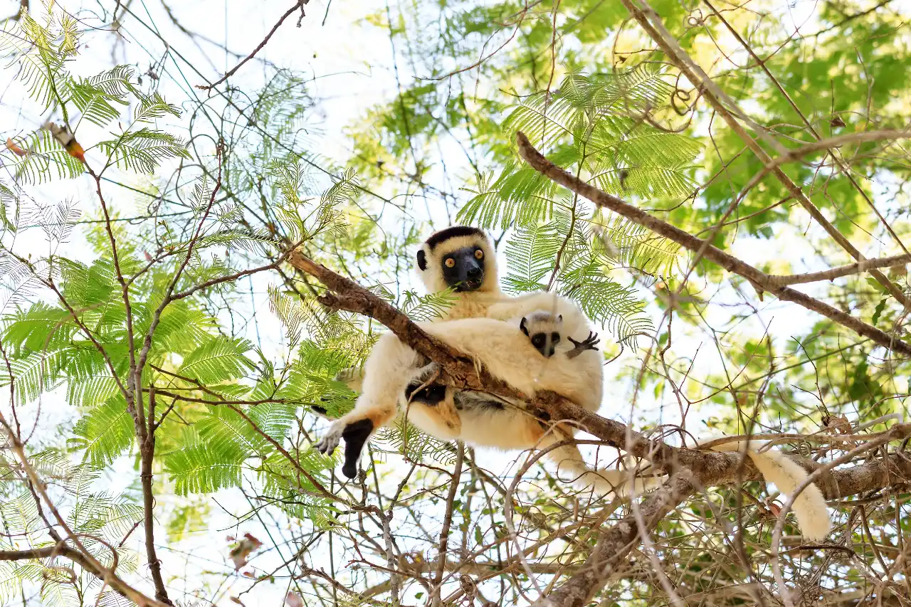
- Dry‑forest lemurs: brown lemurs, Verreaux’s sifaka (Propithecus verreauxi) and mouse lemurs (Microcebus).
- Reptiles: lizards, geckos, non‑venomous dry‑forest snakes; marine turtles occasionally on some beaches.
Flora and vegetation
The vegetation of Kirindy Mitea shows the transition from the sea to the arid interior:
- Estuarine and intertidal mangrove forest
- Dry forests, with baobabs and euphorbias in the savannas
- Xeromorphic shrubs in the spiny thickets on dunes and back‑dunes
They provide important habitats for fishery productivity and coastal protection, as well as connections between marine and terrestrial ecosystems.
Ecological and cultural importance
- Protects: a long stretch of coastline and the coastal dry forests of Menabe (complementing Kirindy North and the other western parks).
- Surrounding populations: fishing towns and rural communities along the coast and estuaries depend on fishing, mangroves and dry forests.
- Integrated coastal‑marine management: the park plays a central role in synergies between artisanal fishing, conservation and forestry activities.
Access and best time to visit
The park is about 10 km south of Belo‑sur‑Mer, reachable by car (≈45 min) or motorised pirogue (≈2 h).
Best period from May to October in the dry season, when tracks from Belo‑sur‑Mer are more passable and tides easier to manage.
From November to April, rains and river flows can complicate access, heat and humidity increase, but mangroves and coastal vegetation are at their greenest.
Tips on tides and practicalities
- Check tide times and local advice before boat trips or beach walks – channels and sandbanks shift with the tides.
- Wear lightweight, breathable clothing, a hat and high‑protection sunscreen; the coastal sun and reflection are intense.
- Use sandals or closed shoes suitable for mud, mangrove roots and hot sand.
- Bring enough drinking water and snacks; services around Belo‑sur‑Mer and in the park are very basic.
Accommodation
- Ecolodge du Menabe
- Entremer
- Belo Beach
Conclusion
Kirindy Mitea National Park is not among the best organised for tourism and presents landscapes of lower density and less abundant coastal biodiversity; it is ideal for those travelling in the wilder parts of southwestern Madagascar. Mangroves, almost deserted beaches, dry coastal forests and fishing villages offer an unfiltered view of the conservation challenges of the coast in the Morondava region.